Geophysical tutorial – How to evaluate and compare colormaps in Python

These below are two copies of a seismic horizon from the open source Penobscot 3D seismic survey  coloured using two different colormaps (data from Hall, 2014).

horizon_comparison

Figure 1

Do you think either of them is ‘better’?  If yes, can you explain why? If you are unsure and you want to learn how to answer such questions using perceptual principles and open source Python code, you can read my tutorial Evaluate and compare colormaps (Niccoli, 2014), one of the awesome Geophysical Tutorials from The Leading Edge. In the process you will learn many things, including how to calculate an RGB colormap’s intensity using a simple formula:

import numpy as np
ntnst = 0.2989 * rgb[:,0] + 0.5870 * rgb[:,1] + 0.1140 * rgb[:,2] # get the intensity
intensity = np.rint(ntnst) # rounds up to nearest integer

…and  how to display  the colormap as a colorbar with an overlay plot of the intensity as in Figure 2.

intensity_dots

Figure 2


Reference

Hall, M. (2014) Smoothing surfaces and attributes. The Leading Edge 33, no. 2, 128–129. Open access at: https://github.com/seg/tutorials#february-2014

Niccoli, M. (2014) Evaluate and compare colormaps. The Leading Edge 33, no. 8.,  910–912. Open access at: https://github.com/seg/tutorials#august-2014

New Matlab isoluminant colormap for azimuth data

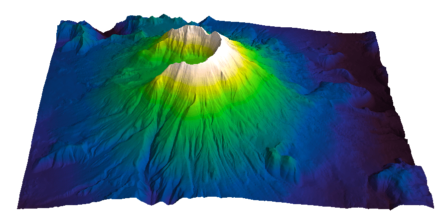
I recently added to my Matlab File Exchange function, Perceptually improved colormaps, a colormap for periodic data like azimuth or phase. I am going to briefly showcase it using data from my degree thesis in geology, which I used before, for example in Visualization tips for geoscientists – Matlab. Figure 1, from that post, shows residual gravity anomalies in milligals.

data cube1_final_shading_slope

Figure 1

Often we’re interested in characterizing these anomalies by calculating the direction of maximum dip at each point on the surface, and for that direction display the azimuth, or dip azimuth.  I’ve done this for the surface of residual anomalies from Figure 1 and displayed the azimuth in Figure 2. Azimuth from 0 to 360 degrees are color-coded using Jet, Matlab’s standard colormap (until recently). Typically I do not trust azimuth values when the dip is close to zero because it is often contaminated by noise so I would use shading to de-saturate the colors where dip has the lowest values, but for ease of discussion I haven’t done so in this case.

Figure 2. Azimuth values color-coded with Jet.

Figure 2. Azimuth values color-coded with Jet.

There are two problems with Figure 2. First, the well-known problems with the jet colormap. For example, blue is too dark and blue areas appear as bands of constant colour. Yellow is much lighter than any other colour so we see artificial yellow edges that are not really present in the data. But there is an additional issue in Figure 2 because azimuths close in value to 0 and 360 degrees are colored with blue and red, respectively, instead of a single color as they should, causing an additional artificial edge.

In Figure 3 I recolored the map using a colormap that replicates those used in many geophysical software tools to display azimuth or phase data. This is better because it wraps around at 360 degrees but the perceptual issues are unresolved: in this case red, yellow and blue all appear as sharp perceptual edges.

standardAZ

Figure 3. Azimuth values color-coded with generic azimuth colormap.


isoAZ

Figure 4. Azimuth values color-coded with isoluminant azimuth colormap.


In Figure 4 I used my new colormap, called isoAZ (for isoluminant azimuth). This colormap is much better because not only does it wraps around at 360 degrees, but also lightness is held constant for all colors, which eliminates the perceptual anomalies. All the artificial yellow, red, and blue edges are gone, only real edges are left. This can be more easily appreciated in the figure below: if you hover with your mouse over it you are able to switch back and forth between Figure 3 and Figure 4.

isoAZstandardAZ

From an interpretation point of view, azimuths 180 degrees apart are of opposing colours, which is ideal for dip azimuth data because it allows us to easily recognize folds where dips of opposite direction are juxtaposed at an edge. One example is the sharp edge in the northwest quadrant of Figure 4, where magenta is juxtaposed to green. If you look at Figure 1 you see that there’s a relative high in this area (the edge in Figure 4) with dips of opposite direction on either side (East and West, or 0 and 360 degrees).

The colormap was created in the Lightness-Chroma-Hue color space, a polar transform of the Lab color space, where lightness is the vertical axis and at each value of lightness, chroma is the radial coordinate and hue the polar angle. One limitation of this approach is that due to theirregular  shape of the color gamut section at each lightness value, we can never exceed  chroma values  of about 38-40 (at lightness = 65 in Matlab; in Python, with extensive trial and error, I have not been able to go past 36 using the Scikit-image Color module), which make the resulting colors pale, pastely.

it creates For those that want to experiment with it further, I used just a few lines of code similar to the ones below:

radius = 38; % chroma
theta = linspace(0, 2*pi, 256)'; % hue
a = radius * cos(theta);
b = radius * sin(theta);
L = (ones(1, 256)*65)'; % lightness
Lab = [L, a, b];
RGB=colorspace('RGB<-Lab',Lab(end:-1:1,:));

This code is a modification from an example by Steve Eddins on a post on his Matlab Central blog. In Steve’s example the colormap cycles through the hues as lightness increases monotonically (which by the way is an excellent way to generate a perceptual rainbow). In this case lightness is kept constant and hue cycles through the entire 360 degrees and wraps around. Also, instead of using the Image Processing Toolbox, I used  Colorspace, a free function from Matlab File Exchange, for the color space transformations.

For data like fracture orientation where azimuths 180 degrees apart are equivalent it is better to stack two of these isoluminant colormaps in a row. In this way we place opposing colors 90 degrees apart, whereas color 180 degrees apart are the same. You can do it using Matlab commands repmat or vertcat, as below:

radius = 38; % chroma
theta = linspace(0, 2*pi, 128)'; % hue
a = radius * cos(theta);
b = radius * sin(theta);
L = (ones(1, 128)*65)'; % lightness
Lab = [L, a, b];
rgb=colorspace('RGB<-Lab',Lab(end:-1:1,:));
RGB=vertcat(rgb,rgb);

Visualize Mt St Helen with Python and a custom color palette

Evan Bianco of Agile Geoscience wrote a wonderful post on how to use python to import, manipulate, and display digital elevation data for Mt St Helens before and after the infamous 1980 eruption. He also calculated the difference between the two surfaces to calculate the volume that was lost because of the eruption to further showcase Python’s capabilities. I encourage readers to go through the extended version of the exercise by downloading his iPython Notebook and the two data files here and here.

I particularly like Evan’s final visualization (consisting of stacked before eruption, difference, and after eruption surfaces) which he created in Mayavi, a 3D data visualization module for Python. So much so that I am going to piggy back on his work, and show how to import a custom palette in Mayavi, and use it to color one of the surfaces.

Python Code

This first code block imports the linear Lightness palette. Please refer to my last post for instructions on where to download the file from.

import numpy as np
# load 256 RGB triplets in 0-1 range:
LinL = np.loadtxt('Linear_L_0-1.txt') 
# create r, g, and b 1D arrays:
r=LinL[:,0] 
g=LinL[:,1]
b=LinL[:,2]
# create R,G,B, and ALPHA 256*4 array in 0-255 range:
r255=np.array([floor(255*x) for x in r],dtype=np.int) 
g255=np.array([floor(255*x) for x in g],dtype=np.int)
b255=np.array([floor(255*x) for x in b],dtype=np.int)
a255=np.ones((256), dtype=np.int); a255 *= 255;
RGBA255=zip(r255,g255,b255,a255)

This code block imports the palette into Mayavi and uses it to color the Mt St Helens after the eruption surface. You will need to have run part of Evan’s code to get the data.

from mayavi import mlab
# create a figure with white background
mlab.figure(bgcolor=(1, 1, 1))
# create surface and passes it to variable surf
surf=mlab.surf(after, warp_scale=0.2)
# import palette
surf.module_manager.scalar_lut_manager.lut.table = RGBA255
# push updates to the figure
mlab.draw()
mlab.show()

After_Linear_L

Reference

Mayavi custom colormap example


Related Posts (MyCarta)

The rainbow is dead…long live the rainbow! – Part 5 – CIE Lab linear L* rainbow

Convert color palettes to Python Matplotlib colormaps

Related Posts (external)

How much rock was erupted from Mt St Helens

Color palettes for seismic structure maps and attributes

I created three color palettes for structure maps (seismic horizons, elevation maps, etcetera) and seismic attributes. To read about the palettes please check these previous blog posts:

The rainbow is dead…long live the rainbow! – Part 5 – CIE Lab linear L* rainbow
The rainbow is dead series – Part 7 – Perceptual rainbow palette – the method
The rainbow is dead series – Part 7 – Perceptual rainbow palette – the goodies

The palettes are available as plain ASCII files and also formatted for a number of platforms and software products:

Geosoft
Hampson-Russell
Kingdom
Madagascar
Matlab
OpendTect
Petrel
Seisware
Surfer
Voxelgeo

Please download them from my Color Palettes page and follow instructions therein.

Enjoy!

linearlfb

Image courtesy of Sergey Fomel of the Madagascar Development blog

Visualization tips for geoscientists – series outline

Visualization tips for geoscientists: Surfer

Visualization tips for geoscientists: Matlab

Visualization tips for geoscientists: Matlab, part II

Visualization tips for geoscientists: Matlab, part III

Comparing color palettes

Introduction

In my last post I introduced a CIE Lab linear L* rainbow palette from a paper by Kindlmann et al. [1]. I used this palette with a map of South America created with data from the Global Land One-km Base Elevation Project at the National Geophysical Data Center. The map is the third one in the figure below.

South_America_maps_LinearL_rainbow

Based on visual inspection I argued that linear L* colored map compares more favourably with the grayscale – my perceptual benchmark – on the right – than the first and second, which use my ROYGBIV rainbow palette (from this post) and a classic rainbow palette, respectively. I noted that looking at the intensity of the colorbars may help in the assessment: the third and fourth colorbars are very similar and both look perceptually linear, whereas the first and second do not.

So it seems that among the three color palettes the third ones is the best, but…..

… prove it!

All the above is fine and reasonable, and yet it is still very much subjective. How can I prove it, convince myself this is indeed the case?

Well, of course one way is to use my L* profile and Great Pyramid tests with Matlab code from the first post of this series. Look at the two figures below: comparison of the lightness L* plots clearly shows the linear L* palette is far more perceptual than the ROYGBIV.

L plot linear L L plot ROYGBIV

One disadvantage of this method is that you have to use Matlab, which is neither free nor cheap, and have to be comfortable with some code and ASCII file manipulation.

Just recently I had an idea for an open source alternative with ImageJ and the 3D color inspector plugin. The only preparatory step required is to save a palette colorbar as a raster image. Then open the image in ImageJ, run the plugin and display the colorbar in Lab space in a 3D view. There are many options to change the scale of the plot, the perspective, and how the colors are displayed (e.g. frequency weighted, median cut, etcetera). The view can be rotated manually, and also automatically.  Below I am showing the rotating animations for the same two palettes.

Discussion

The whole process, including the recording of the animations using  the Quicktime screencast feature, took me less than 10 minutes, and it leaves no doubt as to which one is the best color palette. Let me know what you think.

A few observations: in 3D the ROYGBIV palette is even more strikingly and obviously non-monotonic. The lightness gradient varies in magnitude, resulting in non-uniform contrast. Compare for example the portion between blue and green to that between green and yellow: these have approximately the same number of samples but very different change in lightness value between the extremes. The gradient sign also changes, producing perceptual inversions, for example with the yellow to red section following the blue to yellow. These inversions may result in perceived elevation inversions, for example, if using this palette to display elevation data. On the other hand, the linear L* palette nicely spirals upwards with L* changing monotonically from 0 to 100.

References

[1] Kindlmann, G. Reinhard, E. and Creem, S., 2002, Face-based Luminance Matching for Perceptual Colormap Generation, IEEE – Proceedings of the conference on Visualization ’02

Related posts (MyCarta)

The rainbow is dead…long live the rainbow! – the full series

What is a colour space? reblogged from Colour Chat

Color Use Guidelines for Mapping and Visualization

A rainbow for everyone

Is Indigo really a colour of the rainbow?

Why is the hue circle circular at all?

A good divergent color palette for Matlab

Related topics (external)

Color in scientific visualization

The dangers of default disdain

Color tools

How to avoid equidistant HSV colors

Non-uniform gradient creator

Colormap tool

Color Oracle – color vision deficiency simulation – stand alone (Window, Mac and Linux)

Dichromacy –  color vision deficiency simulation – open source plugin for ImageJ

Vischeck – color vision deficiency simulation – plugin for ImageJ and Photoshop (Windows and Linux)

For teachers

NASA’s teaching resources for grades 6-9: What’s the Frequency, Roy G. Biv?

ImageJ and 3D Color inspector plugin

http://rsbweb.nih.gov/ij/docs/concepts.html

http://rsb.info.nih.gov/ij/plugins/color-inspector.html

The rainbow is dead…long live the rainbow! – The rainbow is dead…long live the rainbow! – Perceptual palettes, part 4 – CIE Lab heated body

  In my last post I discussed the two main issues with the rainbow color palette from the point of view of human color vision, and concluded one of these issues is insurmountable.

But before I move to presenting alternative color palettes, let me give you one last example of how bad the rainbow is. It was sent to me by Antony Price, a member of the LinkedIn group Worldwide Geophysicists. Antony created a grayscale and a rainbow-colored version – using the same data range and number of intervals – of the satellite altimeter derived free-air gravity map of the world [1].  I am showing the two maps below.

Continue reading